The Lords of the Eastern Seas
Sulawan-Panakot
The Iranūn Ancestral Maritime Domain
A Formal Declaration
Restoring the Historical Truth of the Champa Sea
The Sulawan-Panakot portal serves as a formal declaration of the Iranūn ancestral domain and maritime legacy.
For over a millennium, the Iranūn people—recognized as the preeminent navigators of Southeast Asia—have exercised unbroken mastery over the maritime zones now known as the Spratly Islands (Sulawan) and Scarborough Shoal (Panakot).
"Spearheaded by the descendants of the Baì sa Condor and Anta sa Têbouk, this platform aims to project these historical truths into the global academic and legal discourse."
Our Mission
Safeguarding the maritime heritage of the Iranūn by providing a water-tight scholarly framework.
Substantiate
The Philippines' historical rights in the South China Sea through indigenous primary sources, including kirim (scripts), salsilah (genealogies), and oral traditions.
Rehabilitate
The Iranūn identity from colonial-era "pirate" labels to their true status as elite maritime traders and protectors of the regional trade network.
Challenge
Modern geopolitical deceptions with evidence-first cartography and genealogical proof, correcting historical disconnects.
Evidence-First:
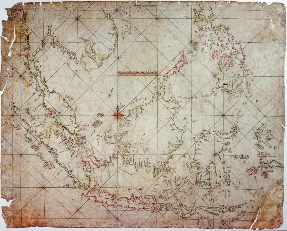
The Carta Indigena Filipina
Explore the only known indigenous Filipino map, an Iranūn-Ugi portulan dated to the 18th century. It depicts the South China Sea in its entirety, marking Iranūn haunts and forward bases—including Palawan—in red highlights.
The Murillo Velarde Map (1734)
Analyze the first European map to record "Panacot" (Scarborough Shoal) using its native Iranūn name, signifying "offering to the Gods" (panakot sa déwata).
Historical Disconnects
Evidence showing that the Chinese "Nine-Dashed Line" fails to account for the essential Southeast Asian trade network, particularly by excluding Pulo Condor (Côn Sơn).
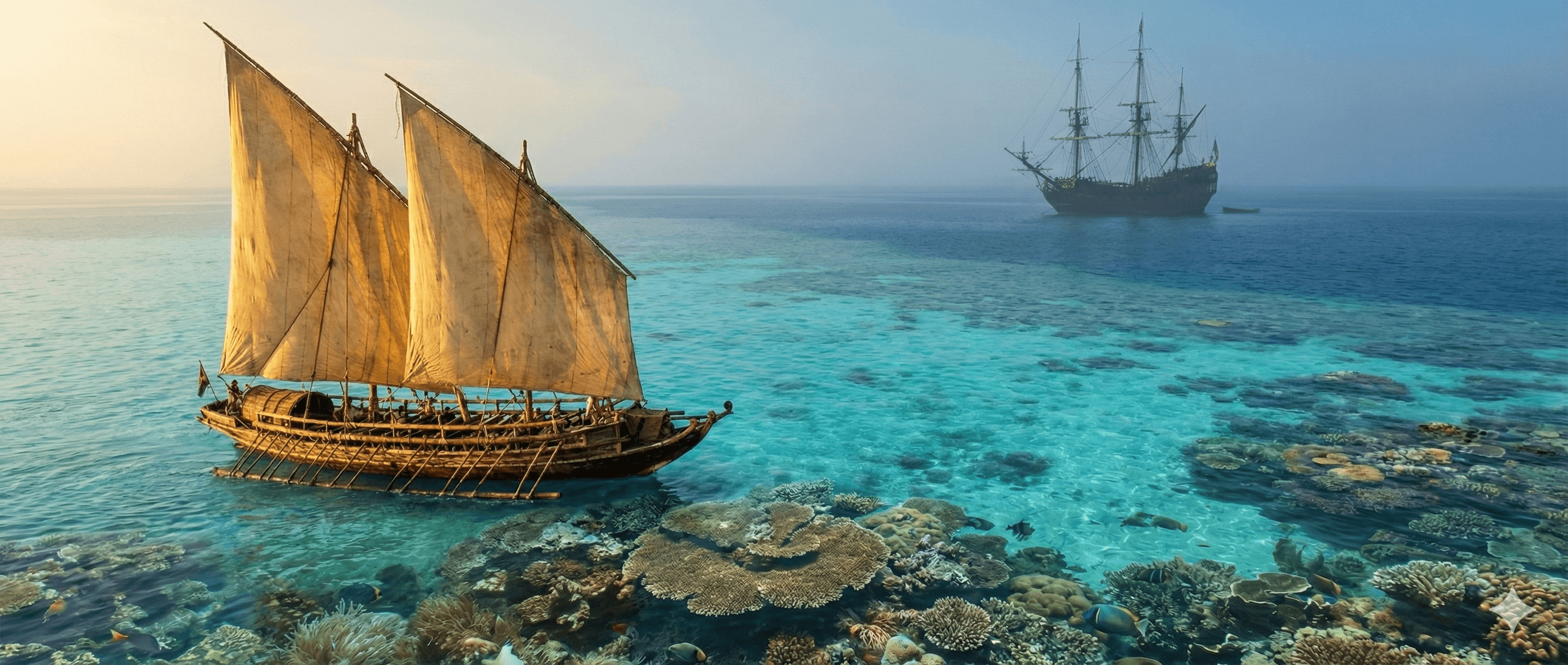
The Science of the Monsoon Riders

The Unorthodox Route
Direct passage through the heart of Sulawan (Spratlys) to reach Champa, unlike coast-hugging foreign vessels.
Kapamitoon
Celestial navigation system mapping stars to navigate thousands of miles without a magnetic compass.
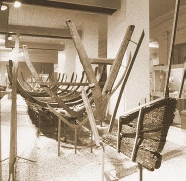
Seagoing Expertise
Construction of the Padau (prahu) using lashed-lug technology for speed and resilience in volatile seas.
Scholarly Substantiation:
Sovereignty and Heritage
Genealogical Sovereignty
Comprehensive database tracking the 10-generation descent of key leaders—such as the late Senator Tomas Cabili—from Baì sa Condor.
The 2023 Declaration
Digitized archive of the Declaration of Provenance signed by the 16 Royal Houses of Lanao regarding Sulawan and Panakot.
Cham-Refugee Steerage
Documents detailing the historical role of the Iranūn in ferrying hundreds of thousands of Cham refugees (10th-18th centuries).